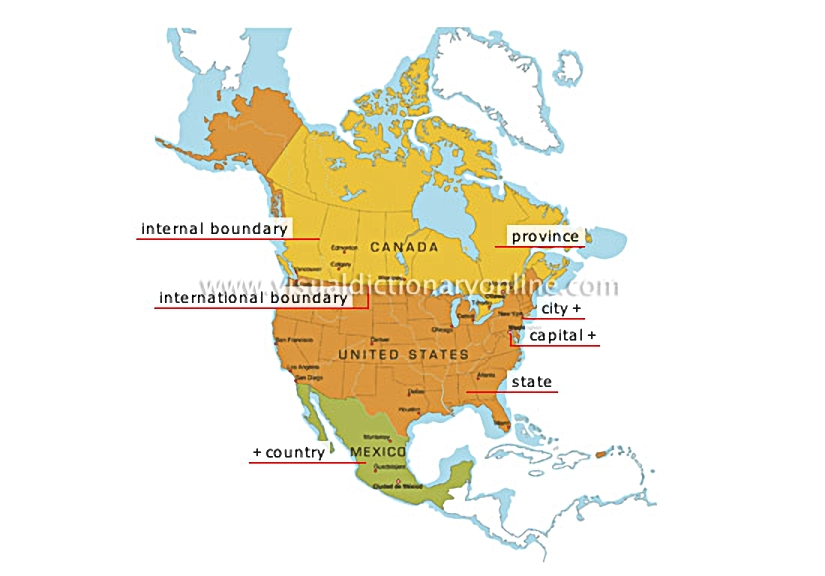
political map

Type of map representing various countries and their territorial or administrative units.
political map 						Territorial division run by a government elected by the population (in Canada) or appointed by a central authority (China).				  							Major urban center, characterized by a concentrated settlement whose activities revolve around industry, commerce, services and administration.												City where the government is located.												Each of the territories constituting a federation; the United States is divided into 50 states.				  							Territory inhabited by a citizenry and administered by a government; its borders are clearly established.				  							Boundary marking a country’s territorial limits.				  							Boundary marking the territorial limits of a province or state within a federated state.
See Also


metropolitan area?[1]

downtown?[1]

physical map

province

Territorial division run by a government elected by the population (in Canada) or appointed by a central authority (China).

city

Major urban center, characterized by a concentrated settlement whose activities revolve around industry, commerce, services and administration.
metropolitan area [1]
downtown [1]
downtown [1]

capital

City where the government is located.
metropolitan area [1]
downtown [1]
downtown [1]

state

Each of the territories constituting a federation; the United States is divided into 50 states.

country

Territory inhabited by a citizenry and administered by a government; its borders are clearly established.

international boundary

Boundary marking a country’s territorial limits.

internal boundary

Boundary marking the territorial limits of a province or state within a federated state.